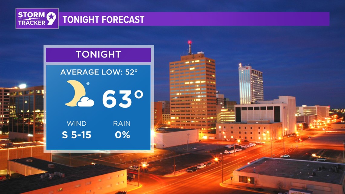
TONIGHT: Over the next 24-36 hours, westerly flow will persist across West Texas and eastern New Mexico, keeping skies mostly clear and preventing any rain chances. However, above-normal daytime highs will prevent temperatures from dropping significantly tonight, with lows in the 50s to 60s, about 10 degrees above normal.
LOW: 63°
WIND: S 5-15 mph.

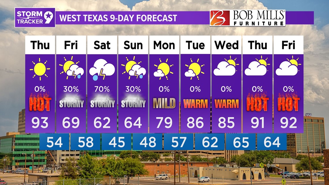
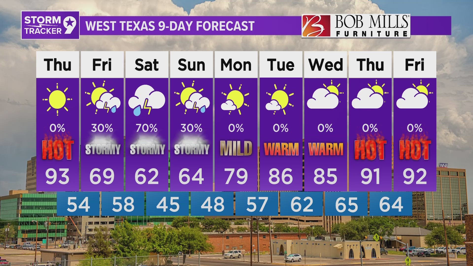
TOMORROW: These warmer overnight temperatures set the stage for a hot day tomorrow, potentially reaching record-breaking temperatures. Highs will jump well into the 90s, possibly even approaching 100 degrees in some lower elevations along the Pecos River. A deep low-pressure system to the north will drive cold air southward resulting in cooler overnight temperatures by Thursday night.
HIGH: 93°
WIND: S 10-15 mph.

IN COMING DAYS: After the hot spring day experienced on Thursday, temperatures will significantly cool across the Permian Basin behind Thursday night's front. The front is expected to stall near the Pecos River valley by Friday afternoon, limiting high temperatures in the Basin to the low 60s due to cloud cover and rain chances, while 70s, 80s, and even some 90s persist south of the front. The front will move southward further on Friday night, leading to a cool Saturday morning with lingering clouds and rainfall chances keeping temperatures in the 50s/60s for most areas again. Forecasting storm coverage and rainfall amounts remains somewhat uncertain as we rely mainly on global models and ensembles at this point. It's anticipated that rainfall will be mostly convective, leading to localized heavy rain in some areas while others may receive little to none.

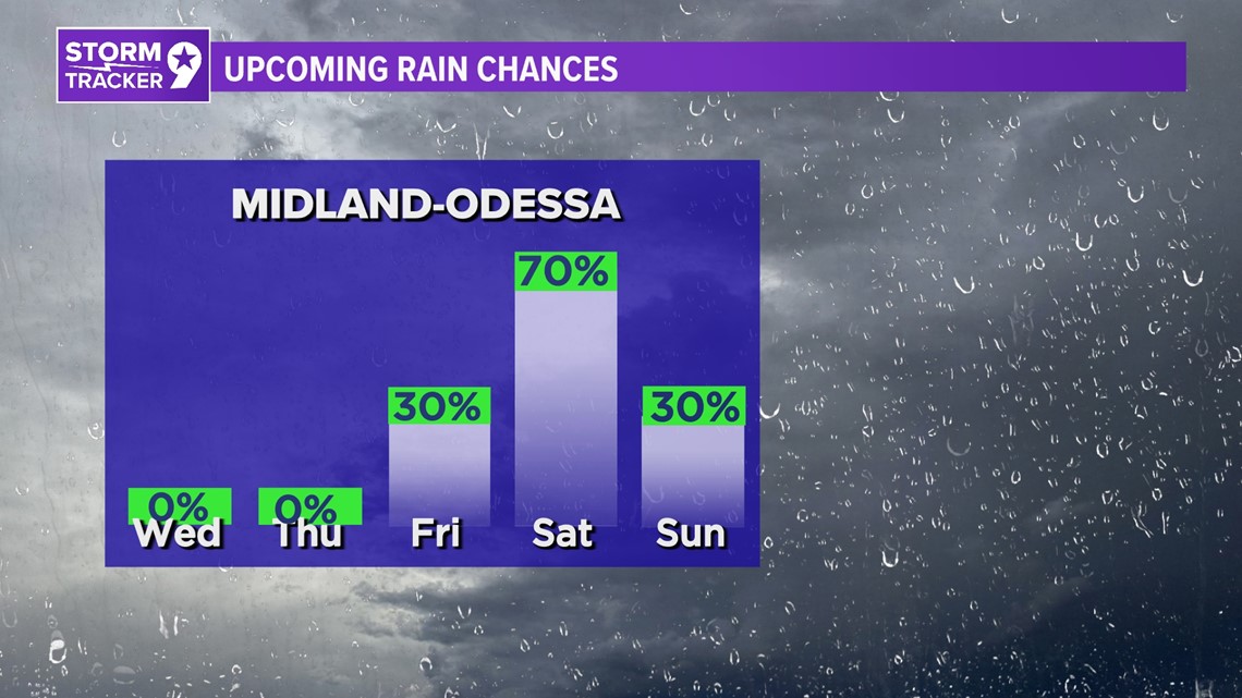
Friday: 30% chance for showers and mostly cloudy with highs near 69°.
Saturday: 70% chance for showers and cloudy with highs near 62°.
Sunday: 30% chance for showers and mostly cloudy with highs near 64°.
Monday: Mostly sunny with highs near 79°.
Tuesday: Mostly sunny with highs near 86°.
Wednesday: Partly cloudy with highs near 85°.
Thursday: Partly cloudy with highs near 91°.
Friday: Partly cloudy with highs near 92°.