
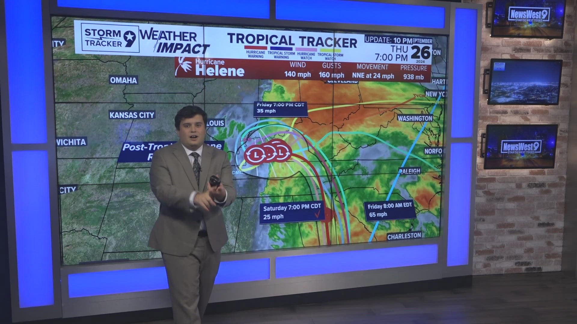
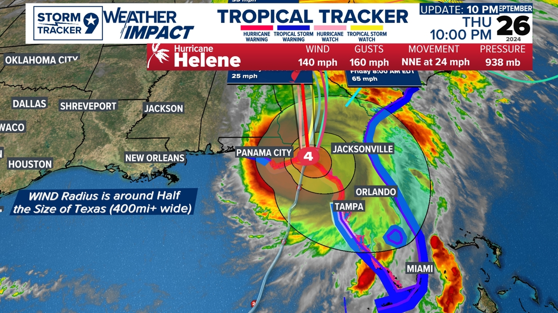
Hurricane Helene has been making major impacts as landfall occurred at 10:10PM as a Category 4 Hurricane with winds sustained up to 140MPH with wind gusts to 160MPH. Helene is a wide system when it made landfall with up to Tropical Storm Conditions being 450MI+ wide which is approximately half the size of Texas. The deep red-orange color represents where Hurricane Force winds are felt and the yellowish polygon outside with the wide range represents the tropical force conditions that can be felt as well.

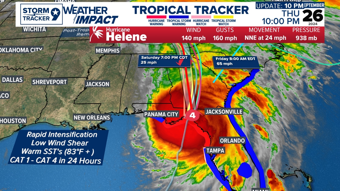
Hurricane Helene underwent rapid intensification within the last 24 hours as of September 26th from a Category 1 to a Category 4 which it underwent Category 4 status on 9/26 5PM. Rapid Intensification occurs when certain characteristics are met with Low Vertical Wind Shear which is a factor that tears apart Hurricane Development as its structure is well defined from its Low-Pressure System. Warm Sea Surface Temperatures are also required typically rapid intensification occurring when temperatures are above 83-85F. The Upper-level trough that brought our cold front helped support upper-level divergence (vertical lift) in our atmosphere to blow up convection within the system expanding it into its huge size. The Upper-Level Trough also helped slingshot Helene into its fast-moving pace also.

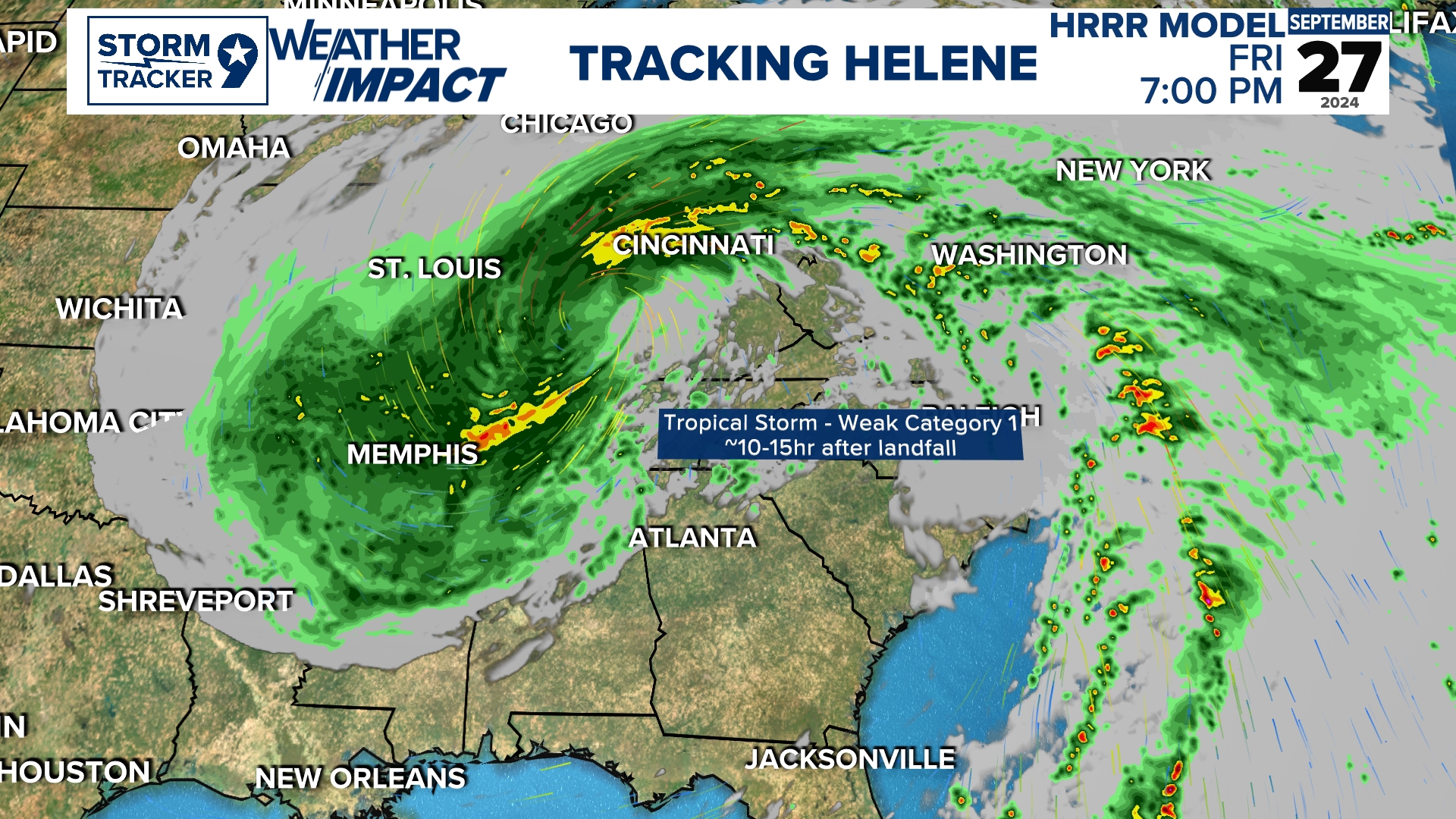
Hurricane Helene is expected to still bring in major impacts into the East Coast with Hurricane Status even as it makes its impacts as the eyewall gets pulled into Georgia as a Category 2 Hurricane with Tropical Storm-possible weak category 1 status late Friday. Current forecasts from 10PM on 9/26 show Hurricane Helene going post tropical by Early Saturday into Saturday night. Heavy rain is still expected when Helene has its Fujiwhara effect with the Upper-Level Trough in which it will bring heavy rain and a major flood threat we head into the early week for the Eastern Portion of the Country.

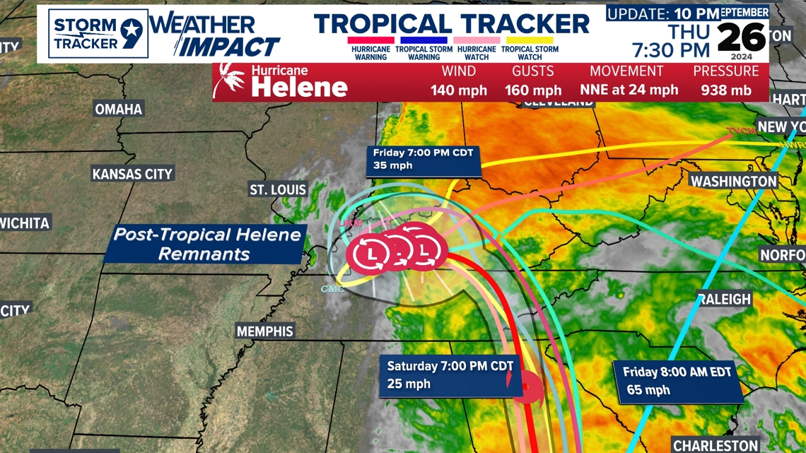
Hurricane Helene while it makes its way north, it is also expected to have its Fujiwhara effect which can be perfectly represented as when the Helene counterclockwise the Upper-Level Trough which we can see with estimated reflectivity as we head into early next week. This is a timelapse of the latest model runs of what could be possible for the East coast and estimated rainfall as we head into early parts of next week.
Feel free to Follow me on Facebook for Detailed Weather Forecasts and Weather Updates!