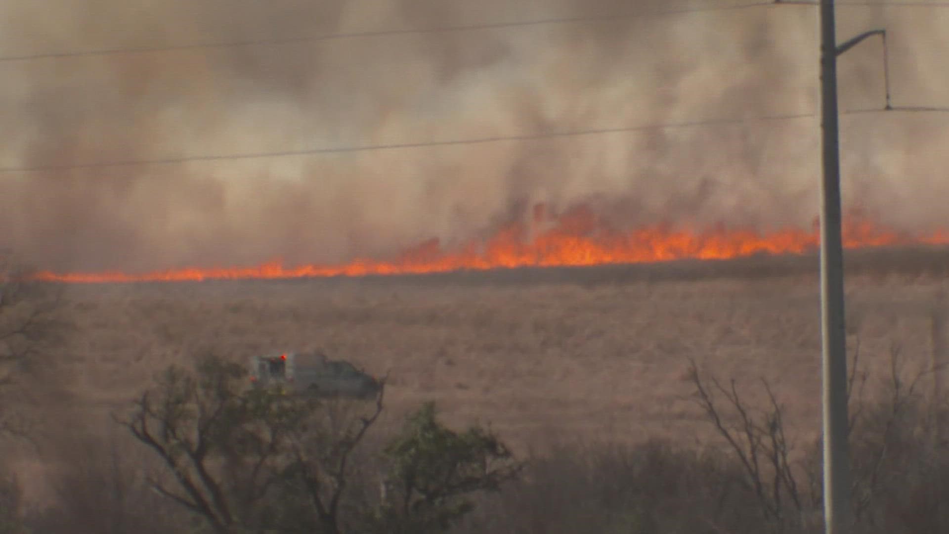
TEXAS, USA — Wildfire potential increases Monday for large, difficult to control wildfires to occur in Southwest Texas, specifically for areas near Del Rio, San Angelo, San Antonio and Laredo, according to the Texas A&M Forest Service and partnering agencies.
The forest service said it is monitoring the current situation closely and has prepositioned personnel and equipment across the state for a quick and effective response to any requests for assistance.


State, local and federal first responders have been increasingly busy with recent response efforts, TAMU Forest Service said. Over the past seven days, firefighters responded to 178 wildfires that burned 108,493 acres across the state.
In San Angelo, Texas A&M Forest Service Public Information Officer Robyn Atwood said for Monday’s expected severe weather, the department will be sending out prevention messages to the public. Atwood said since Texas is a privately-owned state there isn't a whole lot they can do for wildfire mitigation.
A Southern Plains Wildfire Outbreak occurred on Thursday, March 17, across West Central Texas. This weather phenomenon is characterized by extreme fire weather and can be compared to the high impact Santa Ana wildfire events that occur in southern California.
Updates on the fires across the state were given by the Lone Star State Incident Management System late Sunday evening.
According to the Texas A&M Forest Service and Texas Intrastate Fire Mutual Aid System, firefighters responded to several new requests for assistance with wildfires Sunday.
The fire environment Sunday supported the potential for new significant wildfire in areas along and west of I-35 where critically to extremely dry fuel is exposed to elevated or critical fire weather.
Active fires (as of 8:30 p.m. Sunday):
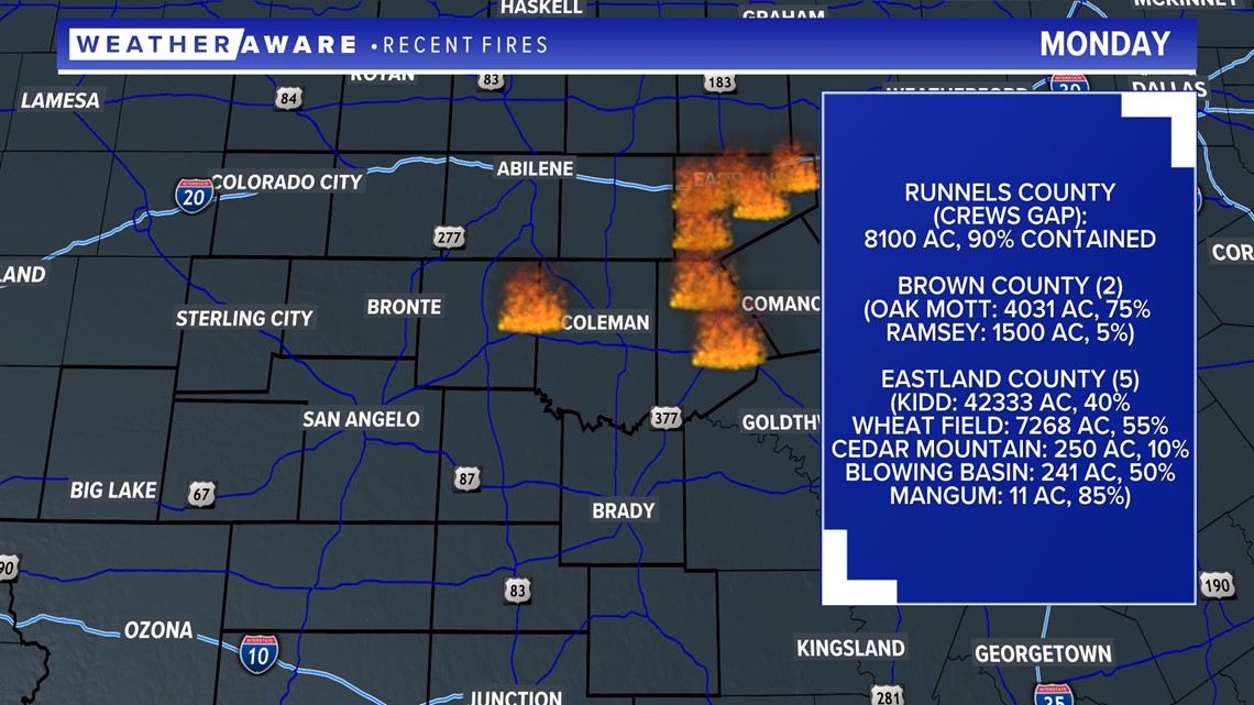
Eastland Complex, Eastland County - estimated 54,015 acres, 30% contained. The acreage for the complex will increase once the new fires are added. With several new wildfire ignitions in Eastland County, the complex now consists of seven fires that are being managed together:
- Kidd Fire, Eastland County (42,333 acres, 40% contained)
- Blowing Basin Fire, Eastland County (est. 258 acres, 50% contained)
- Cedar Mountain Fire, Eastland County (est. 179 acres, 0% contained)
- Oak Mott Fire, Brown County (4,031 acres, 75% contained)
- Wheat Field Fire, Eastland County (7,268 acres, 55% contained)
- Mangum Fire, Eastland County (est. 11 acres, 85% contained)
- Walling Fire, Eastland County (383 acres, 100% contained)
Crews Gap Fire, Runnels County - est. 8,100 acres, 90% contained
Marion 1009 Fire, Marion County - est. 196 acres, 50% contained
Big L Fire, Erath/Hood County - est. 6,000 acres, 5% contained
Three Sections Fire, McMullen County - est. 300 acres, 80% contained
Wells 2 Fire, Archer County - est. 500 acres, 50% contained
Birdwell Fire, Howard County - est. 28 acres, 70% contained
Trinity 1549 Fire, Trinity County - 19 acres, 0% contained
Sunday Late Fire, Live Oak County - est. 400 acres, 70% contained
White Tree Fire, Jim Wells County - est. 40 acres, 95% contained
Cherokee 1728 Fire, Cherokee County - 2 acres, 0% contained
Smith 1823 Fire, Smith County - est. 1 acre, 0% contained
Rifle Club Fire, Reeves County - est. 50 acres, 0% contained
Ramsey Fire, Brown County - est. 800 acres, 0% contained
Contained fires (100%):
Delmita Fire, Starr County - 160 acres
South Shore Fire, San Patricio County - 75 acres
Bowie 1229 Fire, Bowie County - 15 acres
Swamp Fire, Walker County - 3.2 acres
Hopkins 1327 Fire, Hopkins County - 11 acres
Walker 1340 Fire, Walker County - 0.8 acre
Rains 1340 Fire, Rains County - 20 acres
Grimes 1340 Fire, Grimes County - 6 acres
Burnt Pine Fire, Fannin County - 49.1 acres
Walker 1350 Fire, Walker County - 1.5 acres
Clear Creek Fire, Blanco County - 7 acres
Liberty 1423 Fire, Liberty County - 22.7 acres
Upshur 1450 Fire, Upshur County - 60 acres
Pecos Fire, Pecos County - 1 acre
Domingo Fire, Jackson County - 26.6 acres
Middle Creek Fire, Gillespie County - 25 acres
Liberty 1648 Fire, Liberty County - 35 acres
Tyler 1653 Fire, Tyler County - 177 acres
To see the Texas A&M Forest Service statewide active fire response map, go to public.tfswildfires.com.
For frequent incident updates, go to twitter.com/AllHazardsTFS.
The above information, and information on the organization's Twitter page, reflects fires to which Texas A&M Forest Service is responding.

