
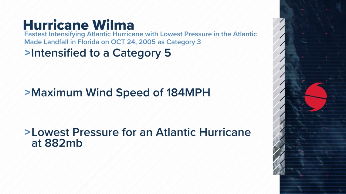
Hurricane Wilma was an Historical Storm with unfortunately major impacts along the Florida's Coast. It holds the record as the fastest rapid intensifying storm in the Atlantic Hurricane Season in which this was in the year 2005 which was the same year we saw Hurricane Katrina & Rita. Rita had a pressure drop of 897mb placing 4th on the list with Hurricane Milton placing 5th on this list with a pressure drop of 897mb. During Hurricane Wilmas intensification to a Category 5 status, it was recorded with the lowest pressure drop in the Atlantic Hurricane Season at 882mb with the lowest on record in the world with Typhoon Tip at 870mbs in 1979. 2005 holds as one of the most impactful Hurricane Seasons to date with a lot of known Hurricanes being from this season.

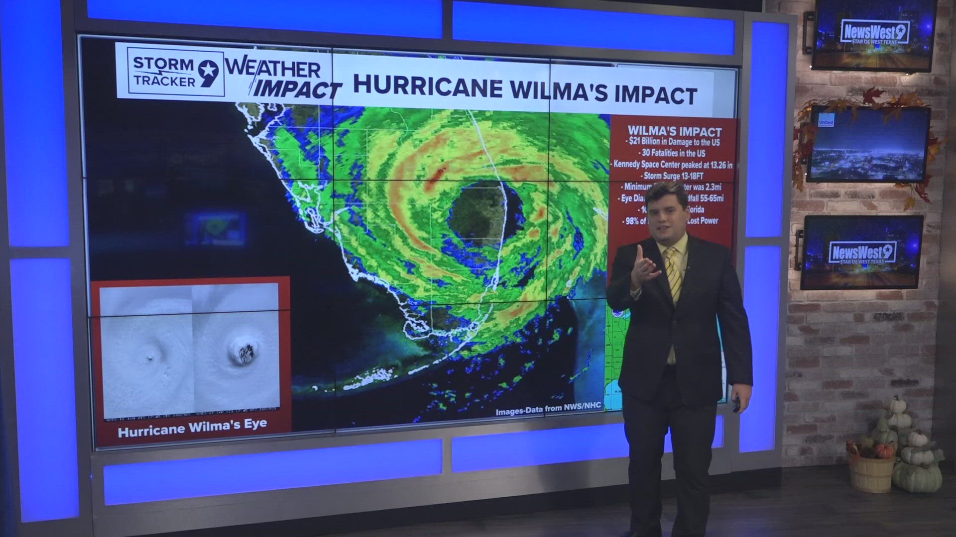
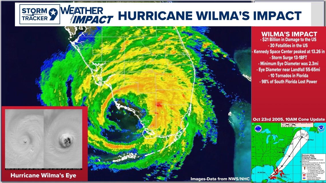
Hurricane Wilma was an historical storm with unfortunate devastating impacts along its landfall in the SW portions of Florida. The US saw some of the most devastating impacts with 13-18ft of Storm Surge and $21 Billion Dollars in Damage to the US. 98% of Floridians in the Southwest Coastal Regions lost power due to Wilma as it made landfall with 10 Tornados within the region. The most interesting fact within this system was when Wilma was intensifying, it had a very small eye which at the time was one of the smallest hurricane eyes to date at 2.3 MI with the nearing landfall eyewall around 55-65MI. Hurricane Milton went through a similar process with a smaller eye wall with it going through an eyewall concentric cycle growing with a bigger eye when it rapidly intensified to its Category 5 status. One thing to always note though with storms, they may take similar paths, but every storm is different with different dynamics and formulations.

Hurricane Wilmas formation originally came off as a Tropical Depression in Jamaica getting into the region of the Central American Gyer turning into a Tropical Storm. Hurricane Wilma rapidly intensified into a Category 5 System on October 19th with the steepest pressure drop of 88mb in just 12 hours with a pressure of 882mb. This still holds as the lowest pressure recorded in the Atlantic Hurricane Season with a recorded wind speed of 184mph. It made landfall slightly over near the Yucatan as a Category 4 system with a 132mph winds at 933mb pressure. Wilma had some complications at first with formation but really kicked into gear later in the lifecycle.

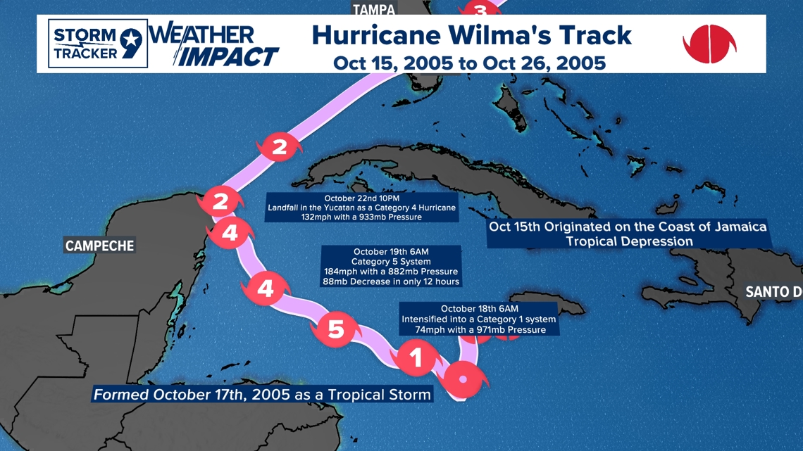
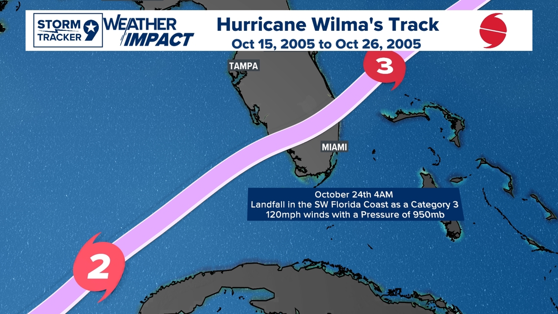
Hurricane Wilma made landfall as a Category 3 Hurricane along the Southwestern Florida coast in the early morning hours of October 24th. The time was approximately around 4-6AM with very minor deintensification with some re intensification just after landfall back to a Category 3. An upper-level trough was the steering mechanism which was the reason it called for a NE turn towards the Atlantic which pulled Wilma like a magnet later turning post tropical way up in the Atlantic Basin with no other impacts in the states after landfall.

Sources and documentation for the data/resources
Feel free to follow my Facebook page for the latest weather updates and breakdowns!