
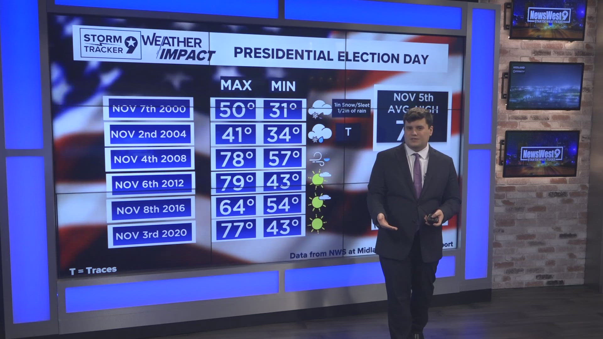
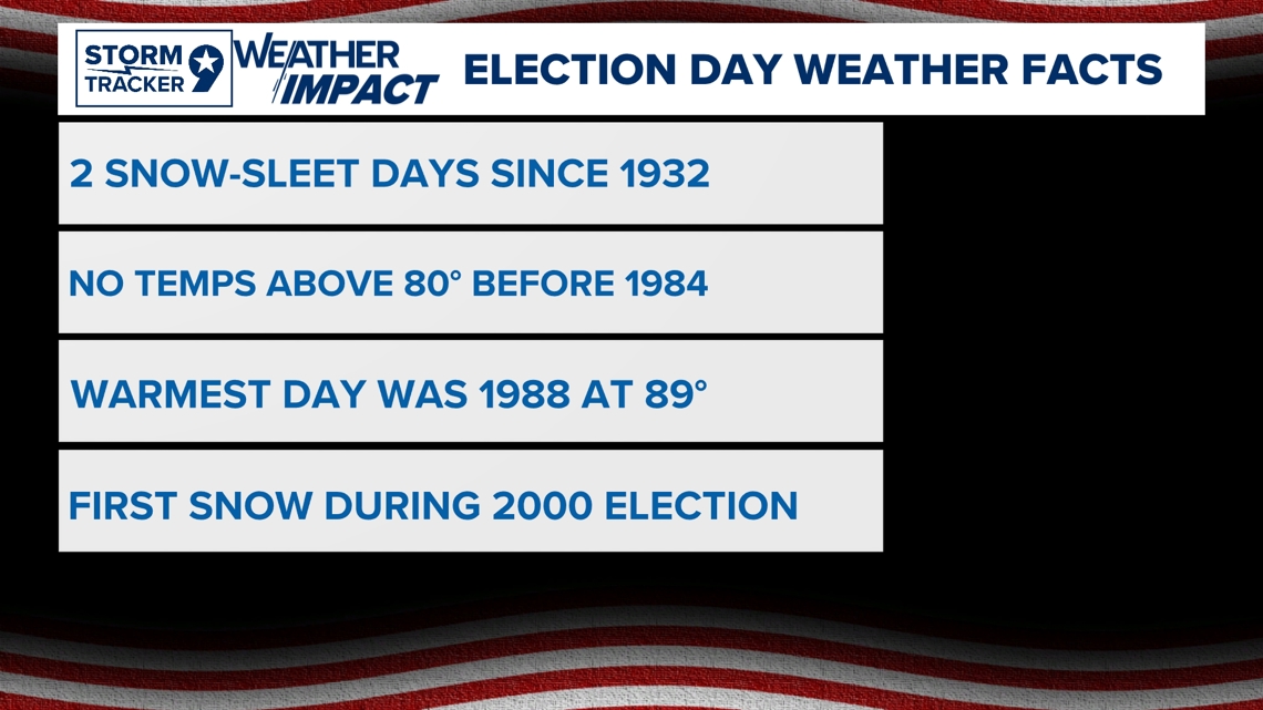
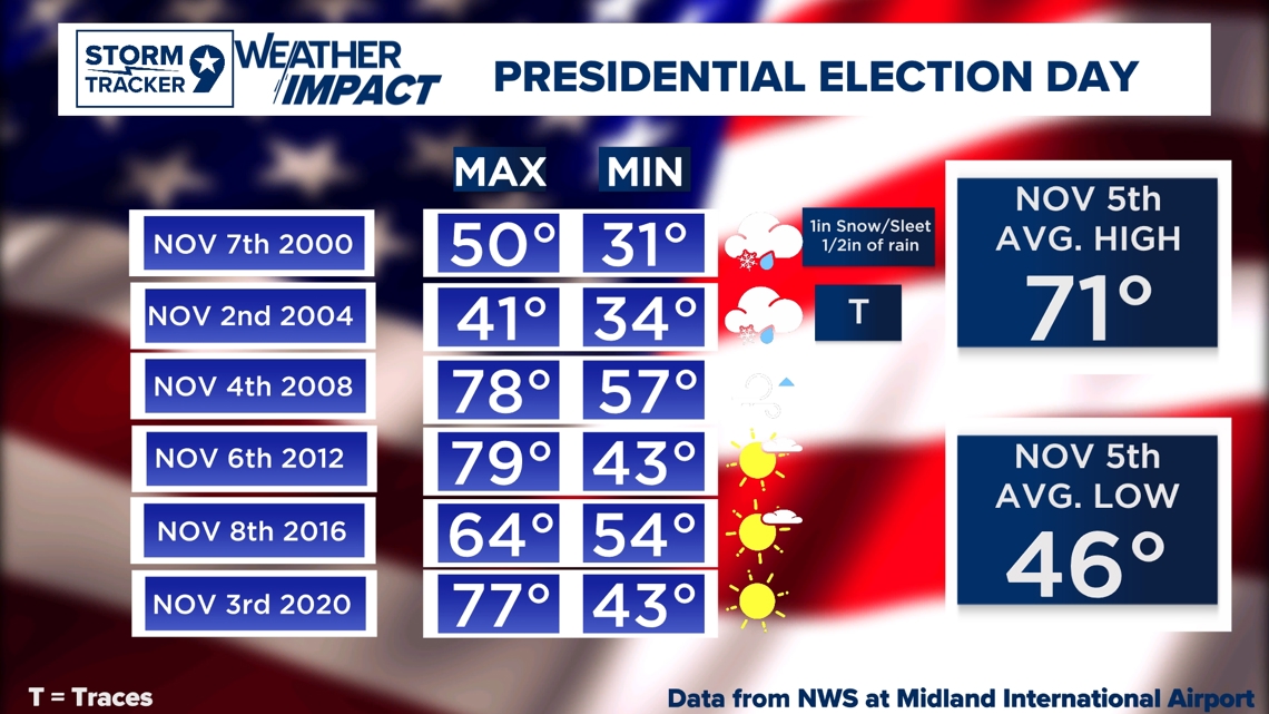
Election day will have everyone outside waiting for the polling stations but one thing we always have to consider being outside is of course the weather. In the Permian Basin, Weather during the Elections has actually had some ups and downs with actually pretty decent weather for the Big Day but also some very cold weather that isn't even close to normal temperatures with freezing temperatures just around our average for when we typically could see our First Freeze. Since the National Weather Service has been keeping data since 1932, there has been two days where Snow/Sleet was present during election day with the first being in the 2000's Presidential Election. We actually have stayed in almost near the averages during our Election Day with some exceptions of course of what we would normally see during the first week of November.

During the 21st Century during past Elections, we have had a variety of weather with actually some snow during the 2000's Election even with small traces of snow/sleet during the 2004 election. These conditions were well below average with actually a stronger cold front that was present on the day of the Election in the Year 2000 with the High Temperature of 50 was actually early in the Morning. After the 2008 Presidential Election, conditions relatively were around average or just above average conditions with actually a great day to be outside with Sunny conditions with a few clouds passing through.

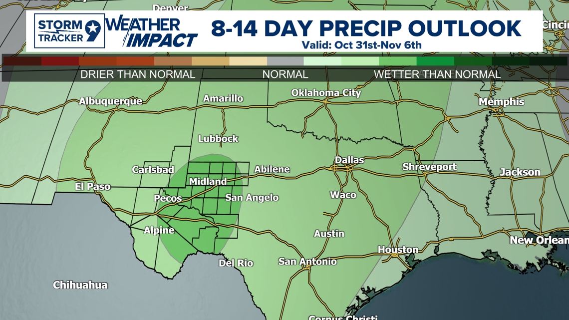
Right now, current model trends on a probabilistic outlook from the Weather Prediction Center. We are currently trending still slightly warmer than average conditions for the week of the Elections. These would actually hopefully be pleasant conditions even if above average conditions with our Average for November 5th being just in the low 70's. Slightly above average conditions would be in the mid to upper 70's if this long trend forecast holds out. Just a reminder though, forecast well after 7 days starts to have some uncertainty's but if these long-term trends start matching with higher confidence, it is a good sign of what could happen.

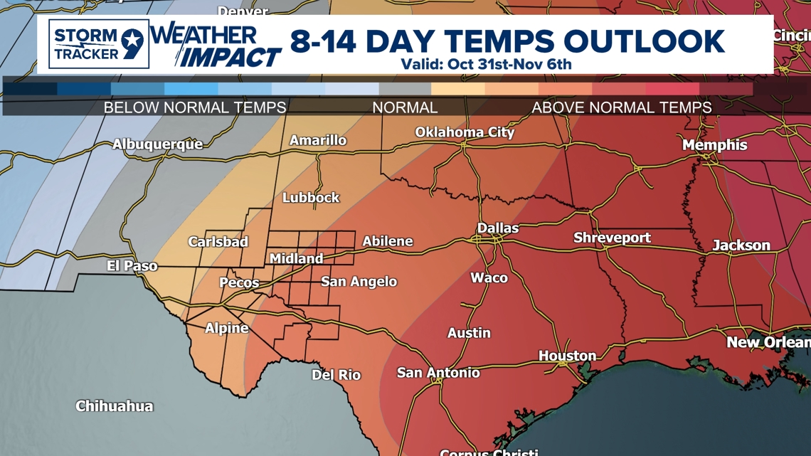
The most interesting aspect with this longer-term forecast trend, we are actually forecasted to be potentially wetter than normal which means between Oct 31st-Nov 6th, we could have some potential rain in the forecast if these forecast trends continue. The wettest Election Day was actually the 2000 Election out of all election days so I'm not saying we could beat that by any means because confidence is still low especially so far out, but it is something to keep an eye on if rain is a potential in the forecast. These forecasts especially this far out doesn't mean we will exactly have these conditions, but more of a trending pattern of what could possibly happen this far out. It can typically serve promising results if the forecast models have been in favor of a persistent pattern. I would look out for that raincoat just in case when elections come around, you don't want to be standing in the rain.

Feel Free to Follow my Facebook Page for the latest weather updates and weather breakdowns.