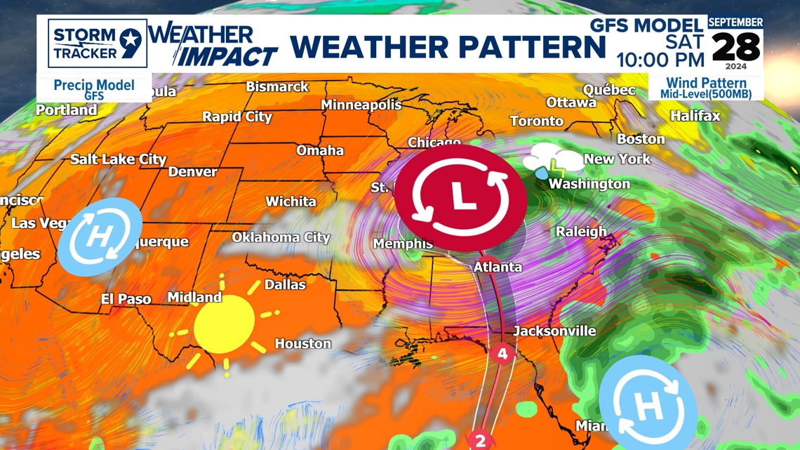
Hurricane Helene is expected to bring dangerous rip currents, storm surge, and major flooding across the Big Bend in Florida into the Mississippi valley over the weekend with dangerous impacts ahead. The Main Concerns with this system is the high impacts for inland flooding due to the high amounts of rainfall and from Storm surge with a tornado risk on the right-hand side of the system also as it makes track northward.

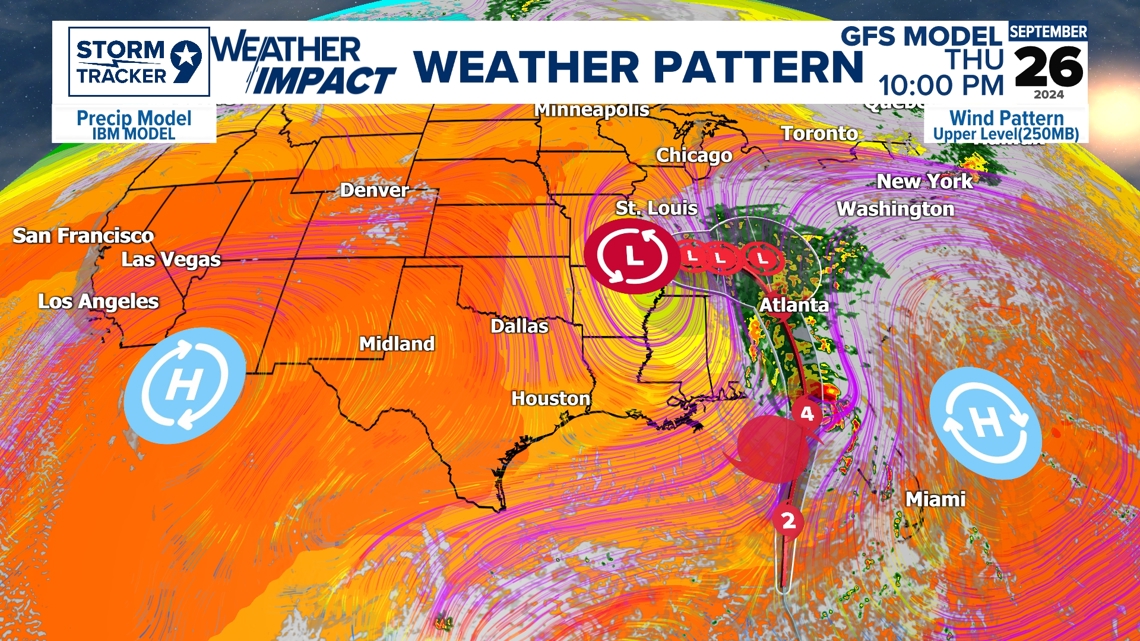
Hurricane Helene is expected to make landfall Thursday evening with tug from the Upper-Level Trough and steering from the High Pressure in the Atlantic making this a fast-moving system as it trends throughout the east coast. This increases risk for storm surge due to its fast-moving pace also keeping the system wide and broad with even major impacts possible outside the cone. The cone represents where the center line could go in which there is always impacts outside the cone as the cone is the representation of the eye of the storm.

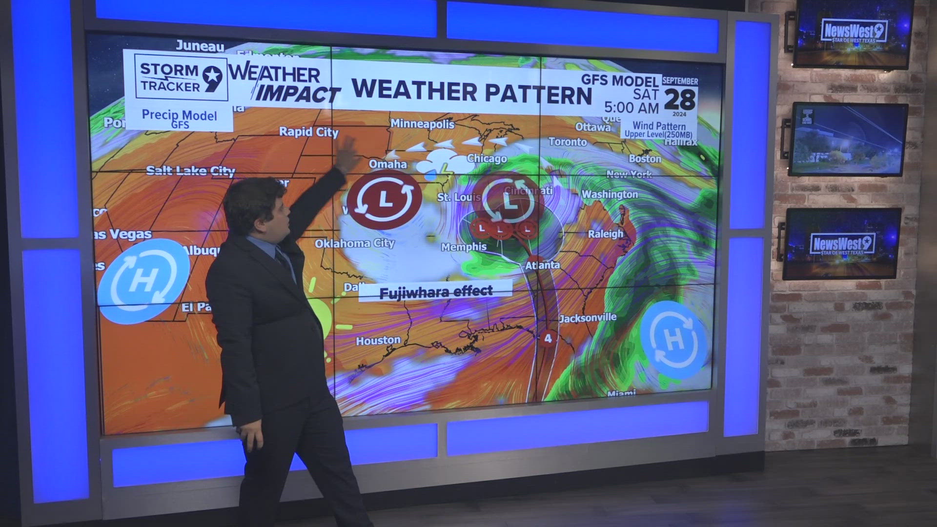
The Fujiwhara effect is when there are two cyclonic systems which in this case is two areas of Low Pressures, it essentially dances around each other in a counterclockwise rotation and either form into one system or slingshots the other. This is a rare weather phenomenon that doesn't occur often in which typically happens with Low Pressure Systems specifically and Hurricanes in which there has been instances where two systems form into one bigger system.

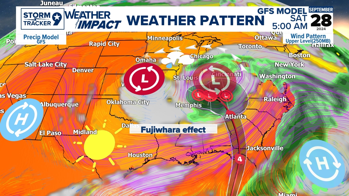
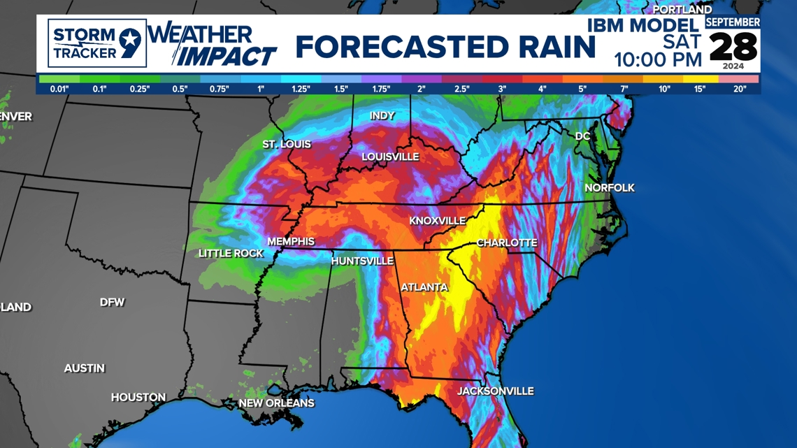
In this case for Helene, the Upper-Level Trough slingshots Helene and merges into one bigger Low-Pressure system bringing sustained rain throughout the Mississippi valley keeping the East part of the country wet and cool with the West side of the County dominated by high pressure keeping us dry and warm.