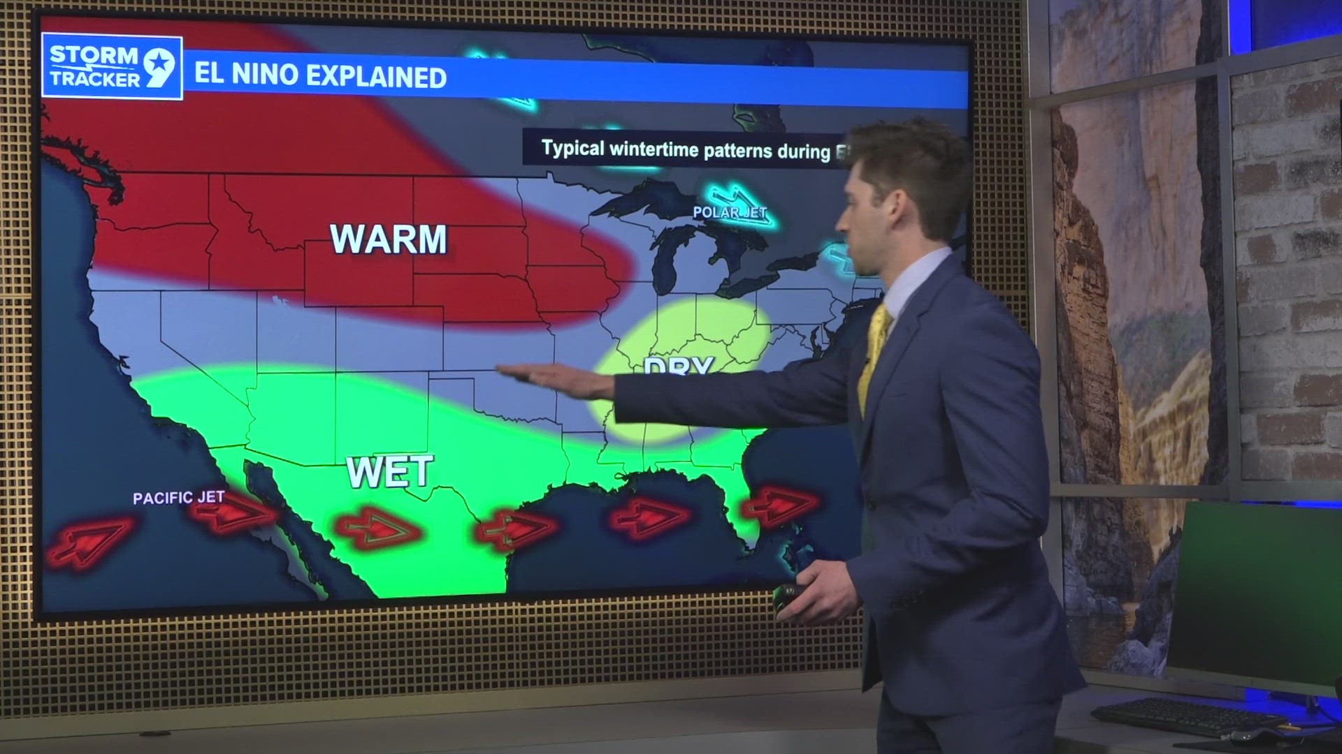
An El Nino weather pattern formed in the Pacific Ocean several months ago back in 2023.
This is when warm waters concentrate over in the eastern equatorial Pacific, close to the coast of South America.
Historically, this pattern has often resulted in the southern United States receiving above average rainfall over the winter months along with colder than average conditions.
The expectation going into this winter was that West Texans would receive above average rainfall amounts this winter.
So, how has this played out so far?
Well, with winter over halfway done, the Permian Basin has received about 0.77 inches since December 1, 2023, the meteorological start of winter. This is below not just what was expected, but also below the 30-year moving average which accounts for El Nino, La Nina and neutral winters.
By this point in winter (Feb. 7), West Texas on average should receive about 1.18 inches of precipitation, whether that be rain or liquid equivalent snow/ice.
Despite it being an El Nino year, the Permian Basin is about 0.41 inches behind what the region usually gets. The drought, however, has actually improved from the rainfall West Texas has gotten.
Part of the reason for this is that West Texans has been close to the rainfall that the region typically gets during this time of year. If people compare that to the summer and fall of 2023, the Permian Basin experienced well below average rainfall.
Midland is currently under a moderate drought status with a good portion of the eastern viewing area under no drought status at all. This is a slight improvement from the start of winter, Dec. 1, when part of Midland and Ector counties were under the severe drought category which is the next level above moderate.
Further good news is that the two-week outlook, going into the middle of February, is expected to have above average precipitation.

