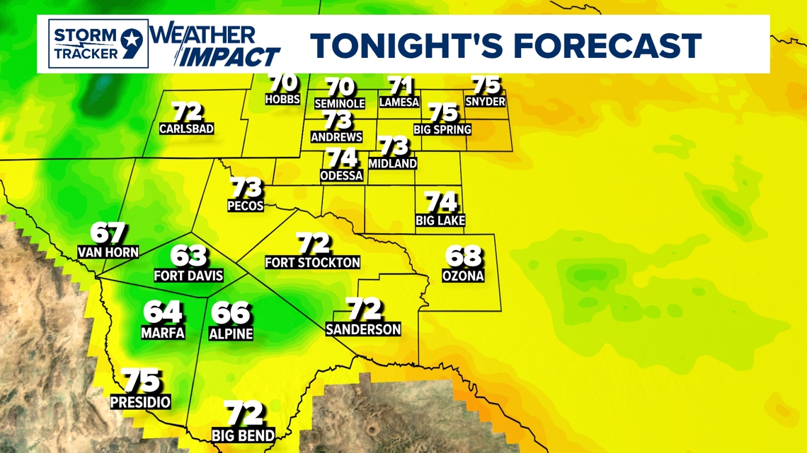
TONIGHT: Temperatures are trending closer and closer to our average lows with the drier conditions making it feel much cooler than the actual temperature which is a great relief after what was last week. The Heat dome officially moves out of the basin which is evidently seen with our forecast for today and tonight with the noticeably cooler temperatures.
WIND: SE 10-15 mph.

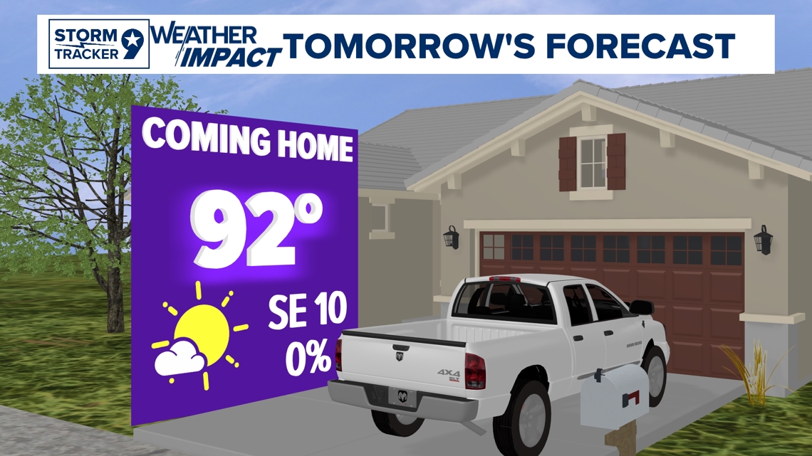
TOMORROW: It will be cooler tomorrow than today with temperatures in the low to mid 90's across the Basin. High pressure moving out gives the atmosphere an opening to develop slight chance of showers tomorrow more leaning towards the afternoon so there is A slight acknowledgement of that with 10% which mostly everyone will possibly not see any rain. It's mostly evident in the eastern county's possible with a shower or two in the higher elevations due to the moisture from the Gulf slowly making its way into the Basin.
HIGH: 92°
WIND: S 5-10 mph.

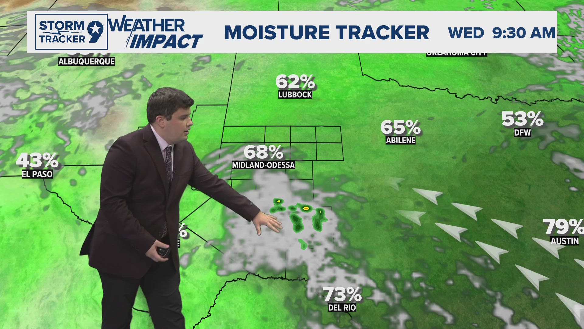
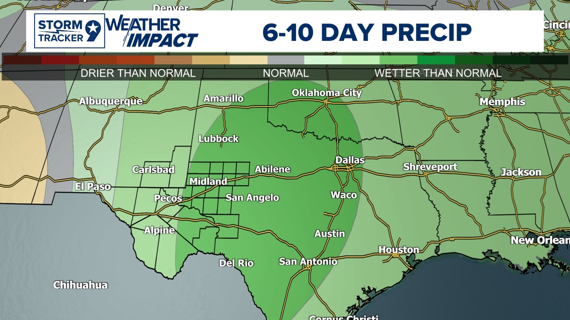
Looking Ahead: There lies some uncertainty in the forecast leading into the later parts in the week due to a couple of reasons. The upper-level disturbance (piece of energy) will make its way into Texas bringing elevated moisture into the Basin but not as significant possibly as another disturbance later into the week pushing moisture in from the West which could push a minor "cold" front into the area. This is where the uncertainty lies the most due to the timing and if more specifically the front could make its way into the Basin. This specific setup could help support potential showers and thunderstorms into the later part of the week and into the weekend. This is acknowledged with the increased wetter than normal conditions from yesterday's outlook for 6-10days in the darker shades of green specifically over West Texas and much of Central Texas. I don't suspect anything severe at the moment but it's something to acknowledge the chances of rain and storms for now. Depending on how the setup plays out, this could be something to keep an eye on but not to worry about as it is still decently far out, and uncertainty mostly for coverage possible is still there. If anything, this could bring great relief to our drought that we are in and is something to look forward to more than anything. In for better news, the 7-day forecast is already looking a lot better with the slight rain chances and cooler temperatures from what last week was!

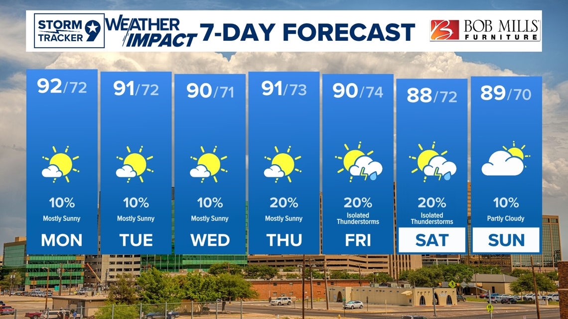
Monday: 10% chance of showers in the afternoon and mostly sunny with highs near 92°.
Tuesday: 10% chance of showers in the afternoon and mostly sunny with highs near 91°.
Wednesday: 10% chance for showers and mostly sunny with highs near 90°.
Thursday: 20% chance of showers and mostly sunny with highs near 91°.
Friday: 20% chance for PM isolated thunderstorms and partly cloudy with highs near 90°.
Saturday: 20% chance for isolated thunderstorms and partly cloudy with highs near 88°.
Sunday: 20% chance for showers and partly cloudy with highs near 89°.