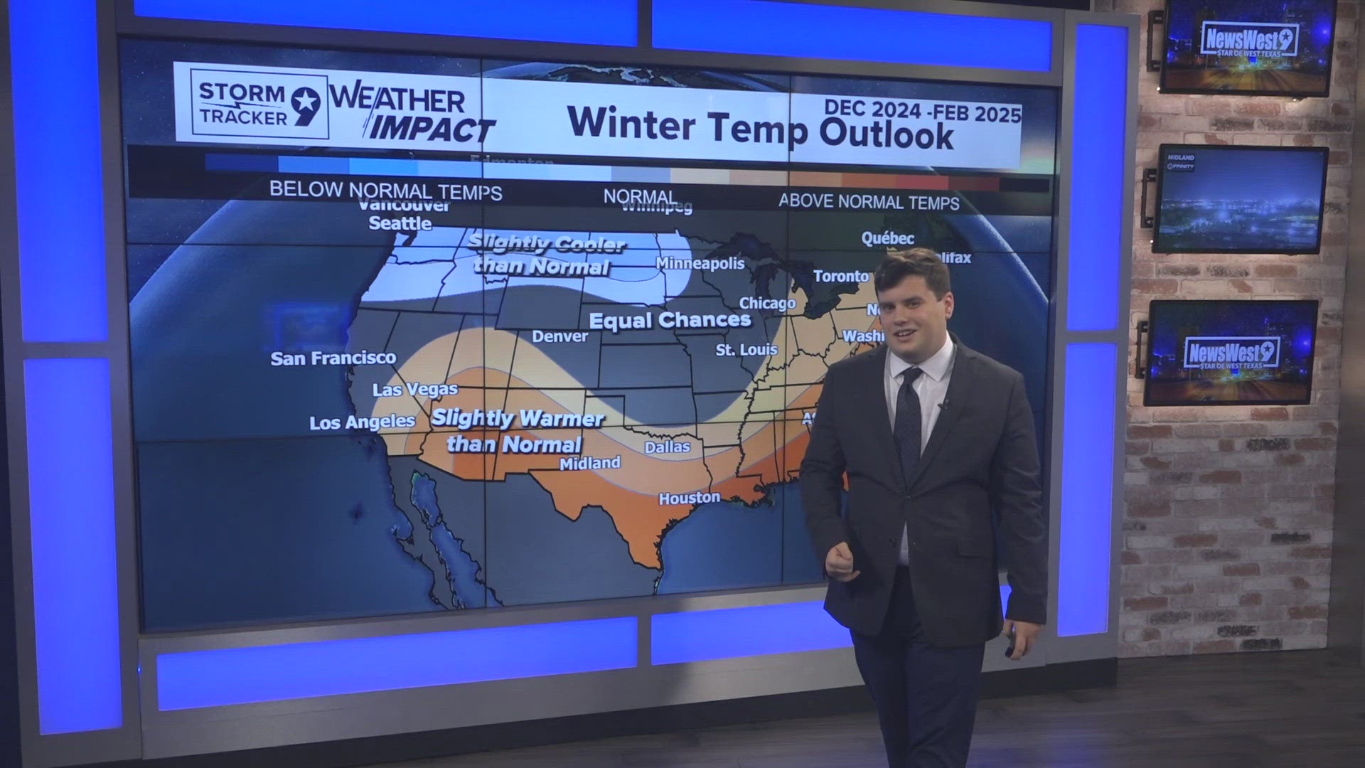
NOAA has recently released the winter outlook for the 2024-2025 winter season. It is an outlook on the probabilities based off our current patterns and outlook within our Teleconnection patterns as La Nina for what could be possible for our Winter Season. Typically on record, we would get our First Freeze during early November with our last freeze of the season being in Late March. This could fair different especially with our weak La Nina season ahead which could have some fair differences in what we typically would see in a La Nina season especially with other factors as in the Madden Julian Oscillation at hand, anything could be on the table for what we could see.

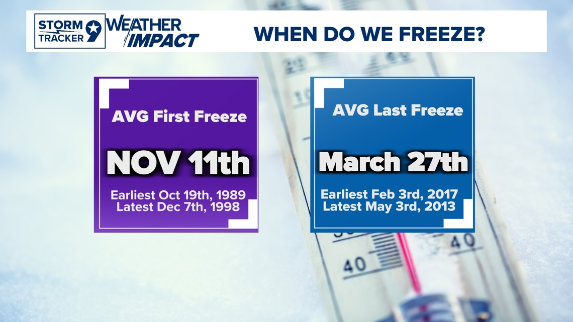
Our busiest time during our winter season is typically between January to February with our best shots of the cooler air. During a La Nina Season, we are known for our best cold air shots during the time as any weakness could really influence a big push of Arctic Air from the West. This could be slightly more altered in La Nina favorable conditions due to a possible Northernly shift in the pattern which could enhance more dominance over our region but with small shifts in the forecast, it can cause big impacts to what type of persist pattern could possibly be. There is a lot of other patterns that are in play that could help assist this but on average during a La Nina season, our region on record usually stays in a Warm and Dry state but of course with weather, it doesn't mean that will be the case the whole winter season.

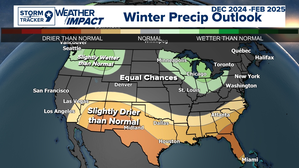
The Precipitation Winter Outlook from NOAA has us in just slightly drier than normal conditions for the Winter Season so far. The next update comes out in November so this could be adjusted slightly. These outlooks are created based on trends of our weather pattern and climatological data with certain setups as a weak La Nina pattern that could possibly bring. Not every weather factor is in consideration considering how much variability other teleconnections patterns could really change in which couldn't be fully considered with these outlooks. This is an overall good way to see what for a possibility heading into our Winter Season with currently how things are shaping out for us and our next Teleconnection pattern La Nina expecting to emerge with a 70% chance by December.

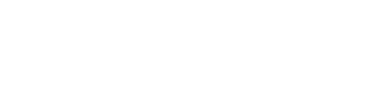
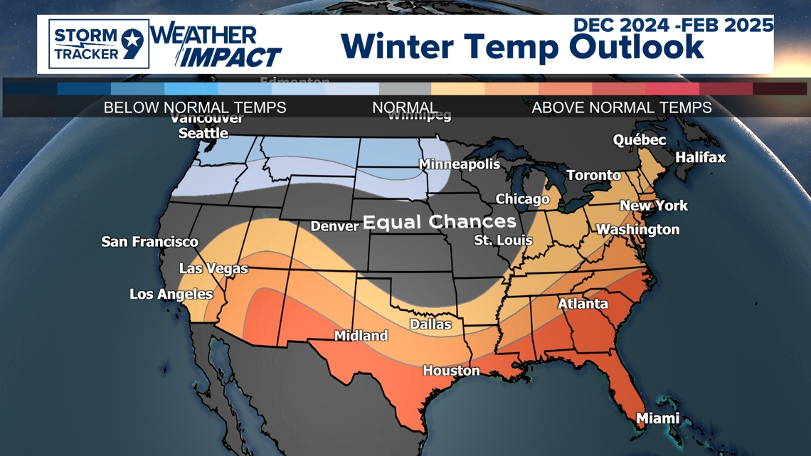
The Temperature Winter Outlook from NOAA has us in slightly warmer conditions than normal conditions heading into our Winter Season. This trends fairly with what a typical La Nina Season would be but with the northward trend in the pattern. This could fair differently with possible warmer conditions. Depending how this northerly trend goes, it could either have good effects with possible near normal conditions due to the La Nina season being weaker or slightly more warmer if it trends more north. This would be because of how the dominant pattern could be which is similar to what we are heading into next week with consistent upper-level flow from High Pressure dominance in the Pacific. Of course, there is other factors as in other oscillations that has a good influence for cold shot from the Arctic but again, this is more of a probabilistic outlook on what trends we are currently having and with the La Nina oscillation pattern ahead. This doesn't again exactly mean we will see this throughout the winter, but more of an idea of what we could expect.

Feel free to follow my Facebook page for more Detailed Weather Explanations and Forecasts