
Cold fronts during the fall and winter season typically come in from the West but due to our weather pattern shifts in the spring, they usually come in from the east due to how the trough can dip. It isn't entirely unusual for them to come from the east during the fall and winter but typically that means our weather pattern is dominant in the west where there was weakness in the east for a trough to make way. When this occurs, we can usually get a Cold Front Meteorologists refer to as a Backdoor Cold Front, which is typically known as a non-traditional Cold front because it comes in from the East to the West when our weather pattern typically traverses from the West to East. It usually has assistance of a High Pressure that helps steer the cooler air down from the East towards the West. One of the main influences as well for West Texas is the concern for blowing dust in which would be more of an issue with our Westward cold fronts.
The general upper-level pattern is still moving West to East with the main dominant feature of the Jet still moving West to East, but our cold fronts with assistance of other weather features push it east to west with the main feature being from the developing are of low pressure.

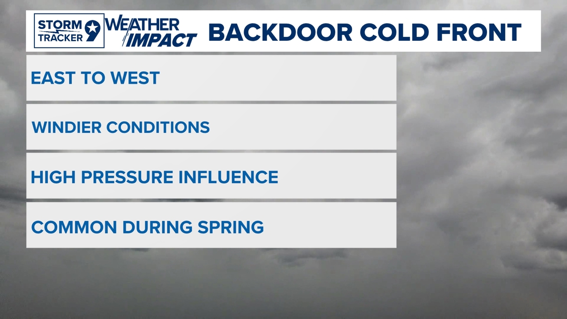
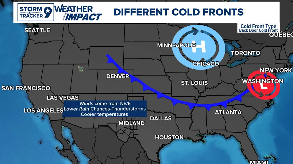
This is a typical setup for a backdoor cold front. It's usually brought in when a Low-Pressure trough as it makes a dip Jet Stream. High pressure can be steered from this system in which high pressure with its clockwise rotation help assist on pushing a cold front down with cooler and drier air. This was the type of situation for this backdoor cold front with High pressure being the dominant feature in the East as it was steered and help assist this frontal system. This type of front doesn't bring as much rain chances as it can still have rain chances associated with it of course, but on a typical setup, rain chances are slimmer. The main dominant feature is how the winds come in form the NE/E in which for a traditional cold front, they come in from the NW/W.

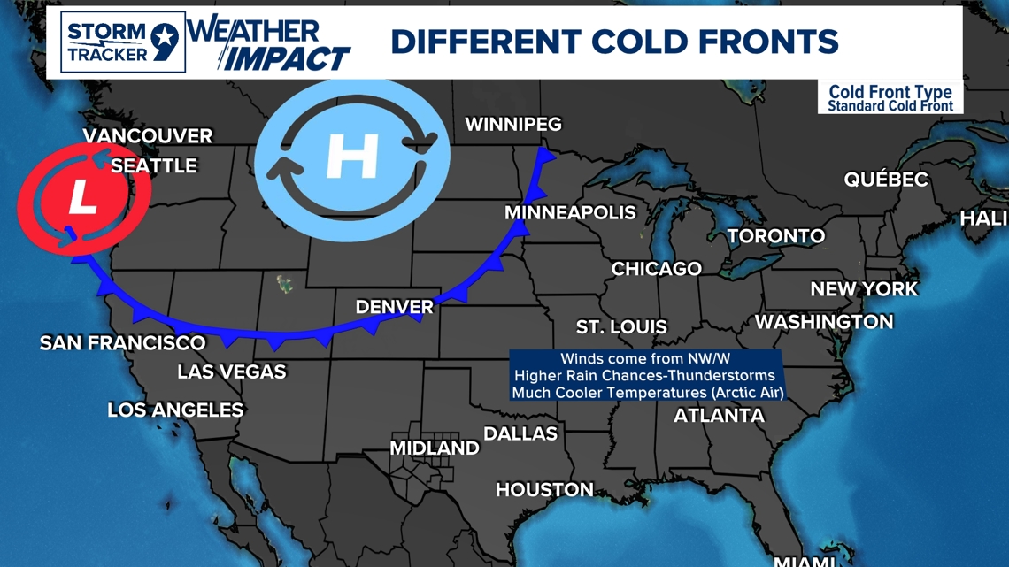
This is a typical setup for a more traditional cold front. High pressure isn't always a present feature but when it is, it would help assist in steering of the winds to bring in the Arctic cooler air into the region throughout much of the states. Usually, the trough is a stronger enough feature where assistance wouldn't be as needed with other low-pressure systems. These are the type of cold fronts that can bring wide-spread snowstorms throughout much of the states with a wider influence with a deeper trough as it traverses west to east. This is a typical cold front situation for the Fall-Winter seasons in the states.
West to East is how our weather patterns traverse due to how our dominant weather pattern in the mid-latitudes due to our general circulation and thermal differences. The Tropics (23.5° North to ~23.5° South) fair different as in between where tropical systems form in which they traverse east to west across the Atlantic; due to Coriolis Force (the apparent force caused by the earth's rotation).

Follow my Facebook page for detailed weather updates!