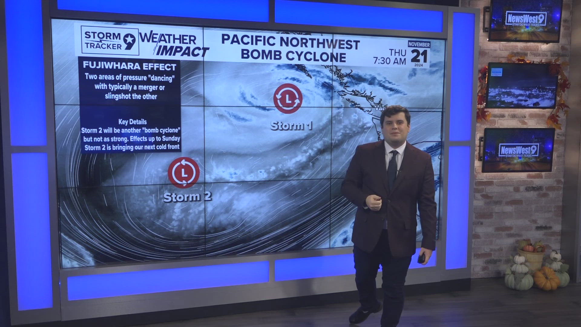
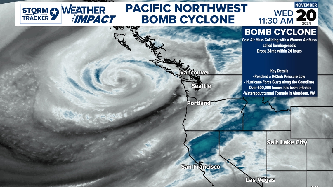
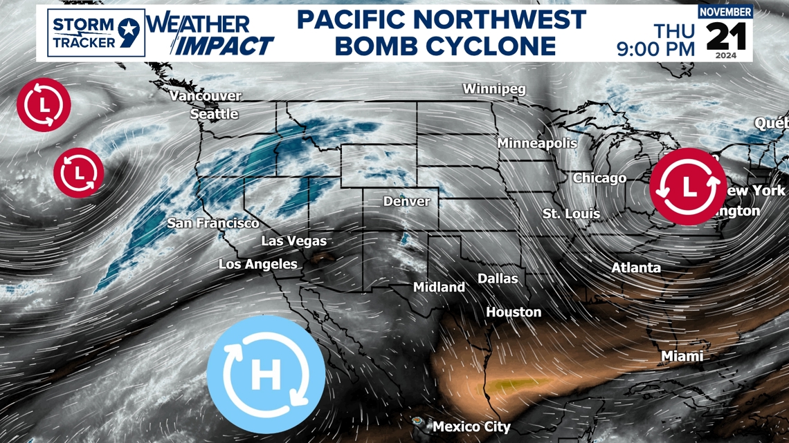
A bomb cyclone has been taking charge in the Pacific Northwest with heavy precipitation and snow for the higher elevations. Gusty winds is also associated with this with the coastlines seeing up to Hurricane Force wind gusts as his system made its close approach near the Northwest. So, what is a Bomb Cyclone, a bomb cyclone goes through a rapid deepening process called Bombogenius dropping 24mb in pressure in 24 hours which is when its officially categorized as a Bomb Cyclone. It's when a cold air mass collides with a warm air mass which the cold air mass in question is the upper-level low from the west. These explosive cyclogeneses are very latitudinal dependent for the change in pressure.

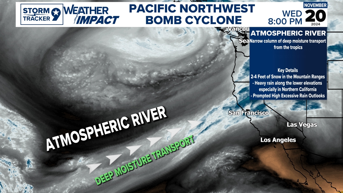
These systems are fueled by energy and one factor that has a lot of energy associated with these systems and very well known in the Pacific Northwest is Atmospheric Rivers. These are deep narrow columns of deep moisture transports from the tropics which is deep tropical moisture that pumps a lot of energy into the Pacific Northwest for heavy precipitation and snowfall across the region. This is a key factor that help elevated heavy snowfall with 2-4 feet with higher localized amounts with heavy precipitation as high as 10-20 inches in some areas with an additional 6-12inches possible especially in Northern California.

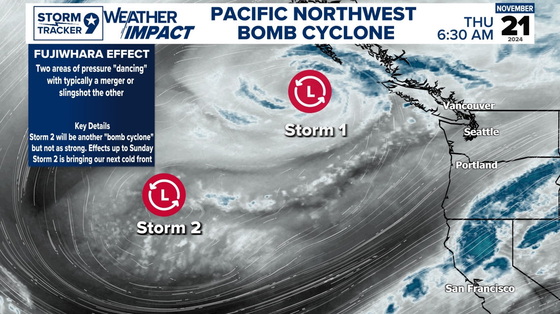
This system is also interesting with another interesting weather phenomenon called the Fujirwhara effect where it's essentially where two cyclonic pressure systems dancing around each other with in this case, our storm 2 will essentially be slingshot from Storm 1. This will be the feature that will bring in our cold front for early next week. Storm 2 will also help level out the atmospheric river to pour more moisture into the region still bringing heavy rain and snow across the region but with less impacts as in wind this time around as it will not rapidly deepen as significant as storm 1. Impacts are expected until Sunday across the Pacific Northwest.

Our weather pattern is having a major effect from this due to these low pressure systems out in the Northwest and Northeast. The Trough in the east is the same feature that brought us our cold front and heavy precipitation across the region which is in fact bring rain and snow for much of the eastern portions of the states especially in areas where it is very welcomed. High pressure ridge is keeping its dominance due to this and able to build into a pretty zonal state especially once the trough out in the east moves on out leaving our awaited cold fronts a bit of a struggle on the way without much give to push through but will just enough to notice a small difference. Once the low-pressure systems out in the west do their dance and get in control, it will make its eventual path west to east bringing in a cold front early week with another one expected on the way just in time for Thanksgiving keeping our temperatures just around average.

Feel free to follow my Facebook page for more in-depth weather details and updates Facebook

