ODESSA, Texas —
What exactly constitutes what we call a severe thunderstorm?
Well, it must fall into one of three categories.
First of all, if wind gusts reach 58 mph or higher, it's a severe thunderstorm.
If we have hail at least 1 inch in diameter, or quarter-sized hail, then that storm is also considered severe.
Lastly, if we have a tornado, of course it's considered severe.
Now we only need to have one of those three things happen to have a severe thunderstorm, not all three.
If we do have a storm and the National Weather Service thinks it meets one of the three criteria, we will get a severe thunderstorm warning polygon.
The NWS in Midland doesn't just give warnings for Midland-Odessa.
They make these warnings for all of West Texas, including Big Spring, Midland, Odessa, Andrews and down towards Pecos and the Davis Mountains. The area even includes two counties in southeast New Mexico.
But how many of these warnings does the NWS actually issue each year?
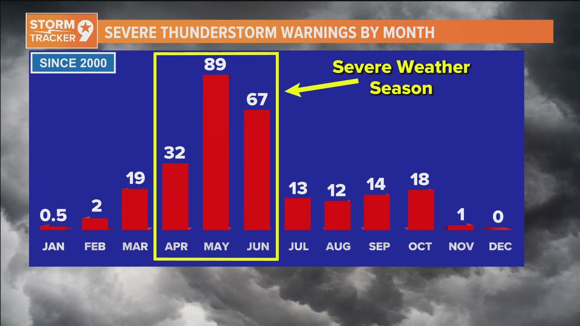
Take a look at it month-by-month and we can see when we have what we call our severe weather season.
We average 32 warnings every April, but we really see that big uptick as we go into May and June, including about 90 warnings every May.
That three-month period is what we call severe weather season for obvious reasons.
But what about tornado warnings? It's pretty much the same story.
We average 24 tornado warnings every year issued by the NWS in Midland.
In just April, May, and June, 82% of those tornado warnings happen.
So, severe weather is here, and it's going to be ramping up in a big way over the next couple of months.

